Distance & Time
The ultimate solution for dynamic route optimization with transit time and shipping distance estimation for sea, air, rail, and road transportation at a glance. Ensure complete visibility in supply chain planning with historical freight route data from shipping lines, prompt and precise calculations, alternatives matching, and interactive real-time world map updates on your route request.

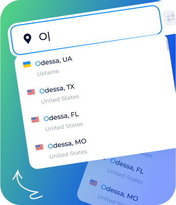
Versatile shipping calculator
-
by Sea
How to calculate distance and time for sea transportation with one tool at once? Explore the ocean freight distance calculator, entering your departure and arrival points to rapidly calculate sea distance port to port for your routes. Discover the sea shipping time calculator features with prompt estimation and scope of historical transit time data from global shipping lines and carriers for sea freight shipping routes of your choice. Compare and save the most appropriate calculation results for efficient enterprise resource planning and supply chain management.
-
by Air
Extended delivery route optimization is achieved by the intuitive tool's rapid air distance and transit time calculations. To plan timely supplies, simply enter two points to find air transit time details for your route. With ease, find distance for air freight in the same interface with a world map that shows your air direction. Compare transit time and air freight distance results for enhanced supply chain management.
-
by Rail
Get your land freight well-planned with transit data and road distance between two locations: cities, towns, villages, places, and addresses. Estimate road freight direction with any cargo requirements in the truck route calculator - get routes visualized on the real-time map and details on upcoming or current deliveries are available with two clicks!
-
by Road
Reliable distance & time estimations for rail freight for the easiest transportation route optimization via a single tool. Specify points of origin and destination, set the speed, and apply for routing mode to get rail wagons moved by the world map in the route distance and rail freight transit time calculator. Achieve transparency in your supply chain with this handy solution for rail freight services calculations.
-
Profitable optimization
With a vast real time distance measurement, you get decision-making results and details on global directions to ensure cost-effectiveness for your supply chain. Implement the automation capabilities of the distance and time calculator at the planning stage of your shipments to ensure precise estimations and an individual approach. Explore the solution to calculate transit time and route distance for completed supply chain management.
-
Alternative routes
The SeaRates distance & transit time calculator is empowered with enhanced logic to find the nearest port, airport, railroad, and road terminals for given locations. Just specify the needed departure and arrival points to get the best destination route calculations. Obtain guaranteed accuracy of routes and improved transit time calculations depending on the average speed you choose.
-
Extensive distance and time calculation
Smart engine to estimate transit time and shipping distance by a range of parameters. Specify coordinates, UN/LOCODES, country codes, countries/cities’ names, addresses in different formats, companies’ names, and even famous places for intermodal and multimodal shipping routes. Get real time transit data and route details for any request type.
-
Broad historical data research
How to figure out time with speed and distance? Start your estimation for trade lanes for average or customized shipping speed. Explore Transit Time Calculator to compare world carriers and shipping line statistics on transit time for your destination. Calculate distance and time from A to B points and discover comprehensive historical transit data for this route. Utilize transit insight for comparing and operating with the options that suit you better.
Restricted routes consideration
How do you calculate distance and time, achieving full trade lanes transparency and thoughtful planning? Explore setting options for safe routes in our route optimization app according to the geopolitical situation in the region of your operations, such as logistics through disputed areas, demarcated lines, and more actual aspects of your supply chain. Apply the best route optimization software with proper geofencing functionality and a comprehensive database of dangerous regions, dynamically updated by SeaRates. Be sure you are aware of all the intricacies of present-day logistics to stay on top of your trading processes.
I want it on my website
Switch route mode
-
safe
Obtain transit time for your shipments to not be crossed by dangerous regions — simply turn on the switch to ‘SAFE’ mode to bypass restricted areas on the map! Automatically set your preferences for doubtful shipping routes and territories according to real-time geopolitical situations.
-
Short
Utilize the ‘SHORT’ routing mode to explore all the capabilities of the fastest route calculator to meet your shipping deadline. Let the ultimate tool provide appropriate and profitable calculations for important shipping route connects Atlantic and Pacific oceans and many more directions worldwide. Compare the safest and shorter distance time graph results to receive personalized shipping estimations for your needs.
-

-
Authorize access for free
Sing up to the SeaRates platform to get time and distance route optimization free with 3 daily calculations and up to 20 unique monthly estimations. Let us know your intention to get the international shipping calculator and receive an individual plan to meet your needs with the best outcomes.
-
-
White-labeled solution
Get your own tool to calculate distance and time between two locations for any type of shipment directly on your website. Utilize the web integration to provide the route optimization software interface under your company’s brand. Comprehensive SeaRates functionality to show your customers how to calculate time by distance and speed settled per demand.
I want it on my website


Language customization
The extensive time distance calculator with global coverage is customized for your company’s audience. Ensure a great experience for your customers with a localized distance & freight shipping time calculator to achieve your service's personalized approach as a regional leader.
Any questions?Attain a high level of freight planning
Request the SeaRates team for a distance & shipping time calculator, empowering your business with accurate route calculation, extensive coverage for multimodal transportation, auto-routing for various transport modes, full route optimization with affordable alternatives, and much more in a single tool. An easy-to-use time and freight distance calculator allows you to put logistics on the automation tracks not only with peace of mind but also with accurate insights and applicable calculations to enhance the supply chain internally.

Looking for ways to scale?
Integrate the best route optimization app with delivery time & shipping distance calculations as an API into your CRM/TMS/ERP. The easy access, extensive functionality, world carriers’ data, voyages insights, and much more are available as per rapid request to the API. Get your own Distance & Time calculator to complete your freight services with the ultimate and customized logistics route optimization solution under your brand. Find out more about the Distance & Time API’s capabilities.